Might be the nicest link between Alaska and the Yukon
(Zur deutschen Version.) On our 15 days roundtrip by car through Alaska and the Yukon this was my personal favorite highway.
This blog post contains unpaid for advertisement and affiliate links.
We leave Tok very early, the place that consists of motels and garages. Nothing holds us here and we want to enjoy the whole day on the Top of the World Highway.
It´s only about 300 km to drive but this highway is very different from most others.
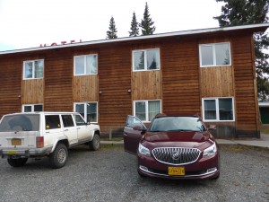
It is really early, it is cold, the mist is still lying on the ground, but the sun is already to be seen at some spots. Nobody else seems to awake. We skip breakfast and get us a cup of coffee in the lobby of the “Golden Bear Motel”. Off we go!
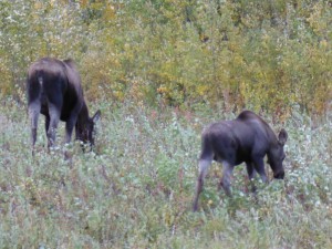
I don´t drive that fast, even though we seem to be the only souls on the street. Maybe I´ve got a seventh sense, because shortly behind Tok a cow moose with her calf stand next to the roadside. Both are munching the grass; they are totally relaxed while we are taking pictures. Maybe curious tourists in a car are no reason to interrupt their meal.
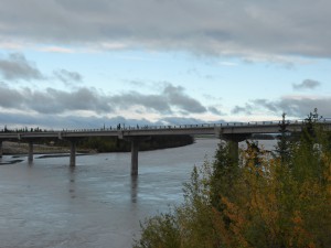
We drive on until we arrive at the bridge over the Tanana River. Again and again I am fascinated by these rivers interspersed by gravel. It´s such a beautiful sight that I stop and take some more photos, until I´ve got the feeling that my fingers will freeze off.
Soon we arrive at the intersection, where I have to turn left. Leaving the Alaska Highway and driving along the Taylor Highway that leads us to the Top of the World Highway later on.
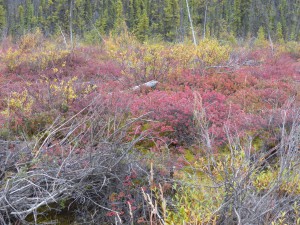
That really good maintained road meanders through forests and rolling hills. Often we get a wonderful view over the amazingly colorful landscape.
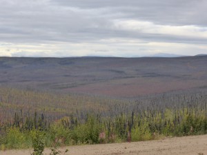
Very soon we have to pass through a very depressing environment. Many miles of burned forest lie before us, only a bit of grass, bushes and some small birch trees, the pioneer plants, can be seen at some spots. 2004 a disastrous forest fire blasted the whole area. Millions of black charred tree trunks still stand upright, some look like exploded from the immense heat of the blast.
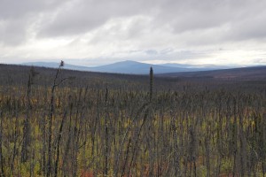
Up and down the hills the blast has killed everything that couldn´t flee the blast. But now and then a tree survived, sometimes a whole bunch that now stand out green in all that black tree corpses. The landscape looks kind of surreal, it´s only good that the sun comes out now and then; that takes away a bit of the sad sight.
I stop the car quite often, we get out and relish the pure air and take some pictures. Very rarely we meet other vehicles. We greet each other from car to car. People are sparse here.
Our stomachs are growling. The coffee is already gone and driving and watching makes us hungry. Shortly before eleven o´clock, nearly 4 hours after our departure in Tok we arrive in the worldwide known jerkwater town “Chicken”. A long time ago it was a prospering place where many gold seekers tried to get rich. Some might have been lucky, but here, hundreds of kilometers away from any civilization, between hills, forest and rivers, everybody must be well prepared to survive.
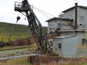
In Chicken we take a look at “Old Jack Wade No 1”, an age-old swimming gold dredge, the first of its kind that was used here in Alaska. It is really impressive and innovative for the end of the 19th century.
I can´t imagine how awful the conditions must have been, when people searched for gold. Being wet all the time, always chilled through. No tumbler that dries the cloths in no time at all. Lucky, who got a proper roof above ones head, more often a tarpaulin was all they got. And then these temperatures…
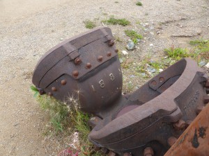
Some pictures and artifacts can be found in the café, where we enjoy some delicious waffles with blueberries and cream. Until 11 am they serve breakfast and we got there 10 minutes before. That´s good luck! The café serves as shop as well. They sell original Alaskan stuff, like jewelry, knitted woolen caps, t-shirts and so on.
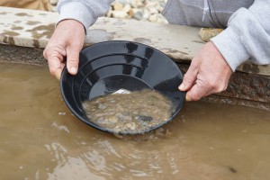
Outside a tourist tries his luck with gold panning; in fact he finds a tiny fraction of gold in his pan that is available in the café. His wife sits behind him in a RV and hands him every now and then a steaming cup of coffee to warm up his nearly freezing hands. The water in which he sieves the sand is really cold, but the air is not much warmer.
During winter time only very few people stay in chicken. Lasting for month they are cut off from the outside world, not everybody is able to live so isolated. Between about October 15th and May 15th , the road behind Chicken that leads to Dawson is closed and to the other side it´s not easy as well. Most of the summer residents, who work here in the RV Park or the little shops, go back to their homes in the South at mid-September.
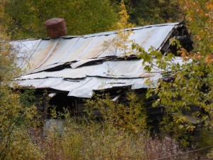
Time gets short and the longest part of our trip lies still ahead of us. From now on it´s going to be a gravel road that goes up and down the hills. Again and again we see the Forty-Miles River, sometimes from high above and sometimes the road goes next to it. Here we see a lot of gold claims; most of them are still in operating state. The river bed and the surrounding area look much scarred here. Gravel humps are everywhere; some are already grown over. There are “No trespassing” and “Private” signs everywhere. Who wants to be looked at while gold panning?
The gravel road is well maintained, anyway careful driving is important, there are still a lot of deep potholes.
Then I have one of my worst moments of my whole trip that won´t leave me for the rest of the day and that comes back at odd moments during my trip. A cute little squirrel runs from the left side directly into the wheels of our car; I try to brake but it´s too late. How awful! I have to stop the car, while tears run down my face. That poor little creature; I hope that one of the many ravens takes advantage of the body, so that its death is not in vain.
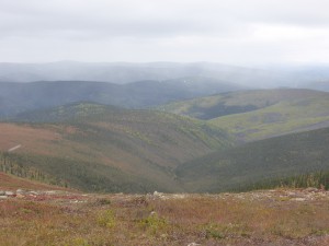
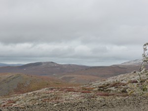
The road winds higher and higher up the hills until we reach the treeless hill top. It gets colder and colder, the mountains that are higher have all got a white cap. It is really cold, the wind blows heavily. Shortly before we reach the Canadian border we get off the car to take some more photos. The wind nearly knocks me over.(Find a short video about the road here.)
We pass the Canadian border and now we are on the “Top of the World”, or so it seems. The road meanders along the hilltops. Only small parts are tarred. The wind lessens a bit, but the clouds get a dark grey color and then it starts to rain. Soon it changes to snow flurry. There is nearly zero sight. I´m happy, that we are not too far away from Dawson.
The road goes hill down now all the time. The snow changes to rain and the road is nicely tarred now. There is Dawson! I can see it through the trees. The famous city of the gold rush! Between the city and us flows only the Yukon River.
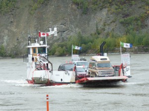
We arrive just in time at the so called ferry terminal, which is only some gravel, rolled plain every day by a huge power shovel and a steamroller.
We roll on the ferry. Our car and all the other vehicles look like they have just survived a mudslide. Partly the road was really muddy… Three bikers stand right next to us. On their plates I can see that they come from Germany. Their bikes and they themselves, two men and one woman) doesn´t look better than our car. They tell us, that they came all the way from New York and they are now heading south to Tierra del Fuego. Wow! That is a long way!
How it´s going on in Dawson I´ll tell you next week. Stay tuned to my blog! News and more pictures you always find on my facebook site (I like it when you “like” it ), or on Instagram and Pinterest. See you there and don´t forget to leave a comment at the bottom!
[…] (For English go this way please.) Auf unserer 15 tägigen Alaska und Yukon Highlights Tour mit dem PKW ist dies meine persönliche Lieblingsstrecke geworden. Wir verlassen Tok, diesen Ort, der nur aus einigen Motels und Tankstellen zu bestehen scheint, sehr früh. Hier hält uns nichts und wir wollen den ganzen Tag auf dem Top of the World Highway genießen. […]